
Aerial Topographic Mapping

Aerial Topographic Mapping
Topographic mapping is a routine task for solar plant design and construction projects. Visualise your solar plant project using high-resolution aerial data at the fraction of the time and cost of traditional methods.
Using a combination of both aerial and ground-based methods, Above delivers a high-resolution map of the site including accurate elevation data.
Advantages of Above’s solution

Industry leading quality
Our services are designed specifically for your project’s needs.

Time and cost effective
Aerial topographic mapping saves you time compared to traditional surveys and at a fraction of the cost

Real-world accuracy
Aerial flight routes are planned by our experienced team, ensuring sufficient row/column overlap. Using GPS-RTK to take ‘ground control’ points across the site to ensure real-world accuracy.

Make informed decisions
Design your solar plant with confidence using aerial topographic data to inform your design decisions

Team Collaboration
Effortlessly geolocate, store and share site visit data and Tasks in our SolarGain & SolarGain mobile

Plan for the future
Store a visual and spatial record of the land state before plant construction
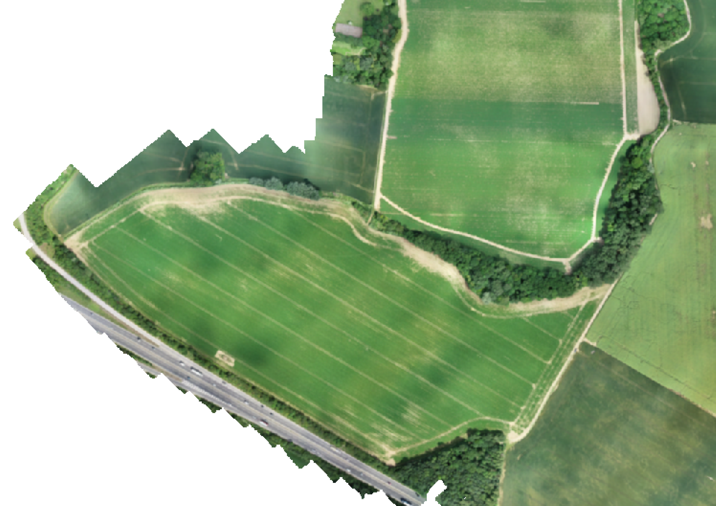
Orthomosaic
A highly accurate and detailed top-down 2D orthometric image of your entire site.
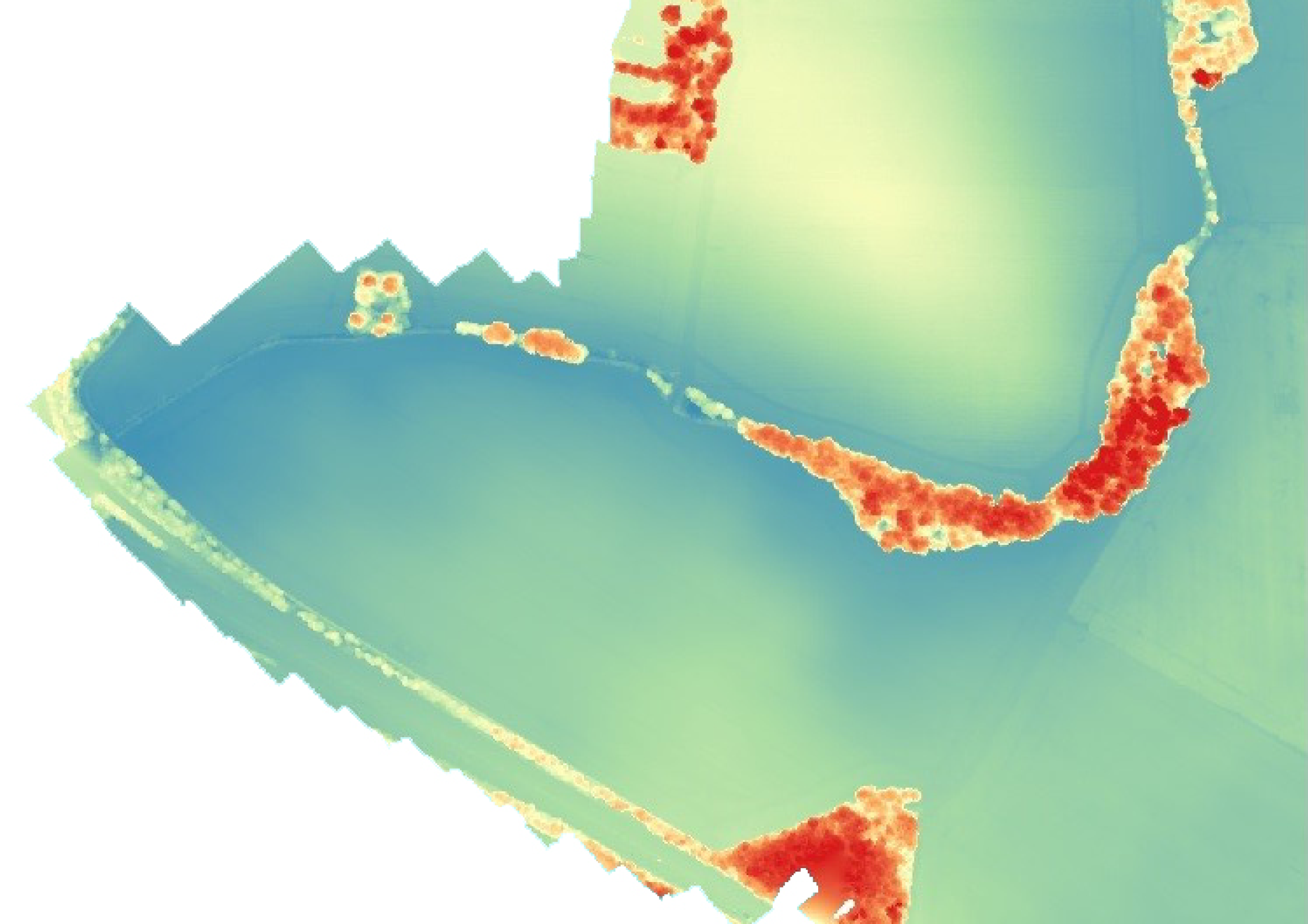
Digital Surface Model (DSM)
A full digital elevation model of your site showing the elevation of every pixel. A useful tool for confirming terrain profiles.


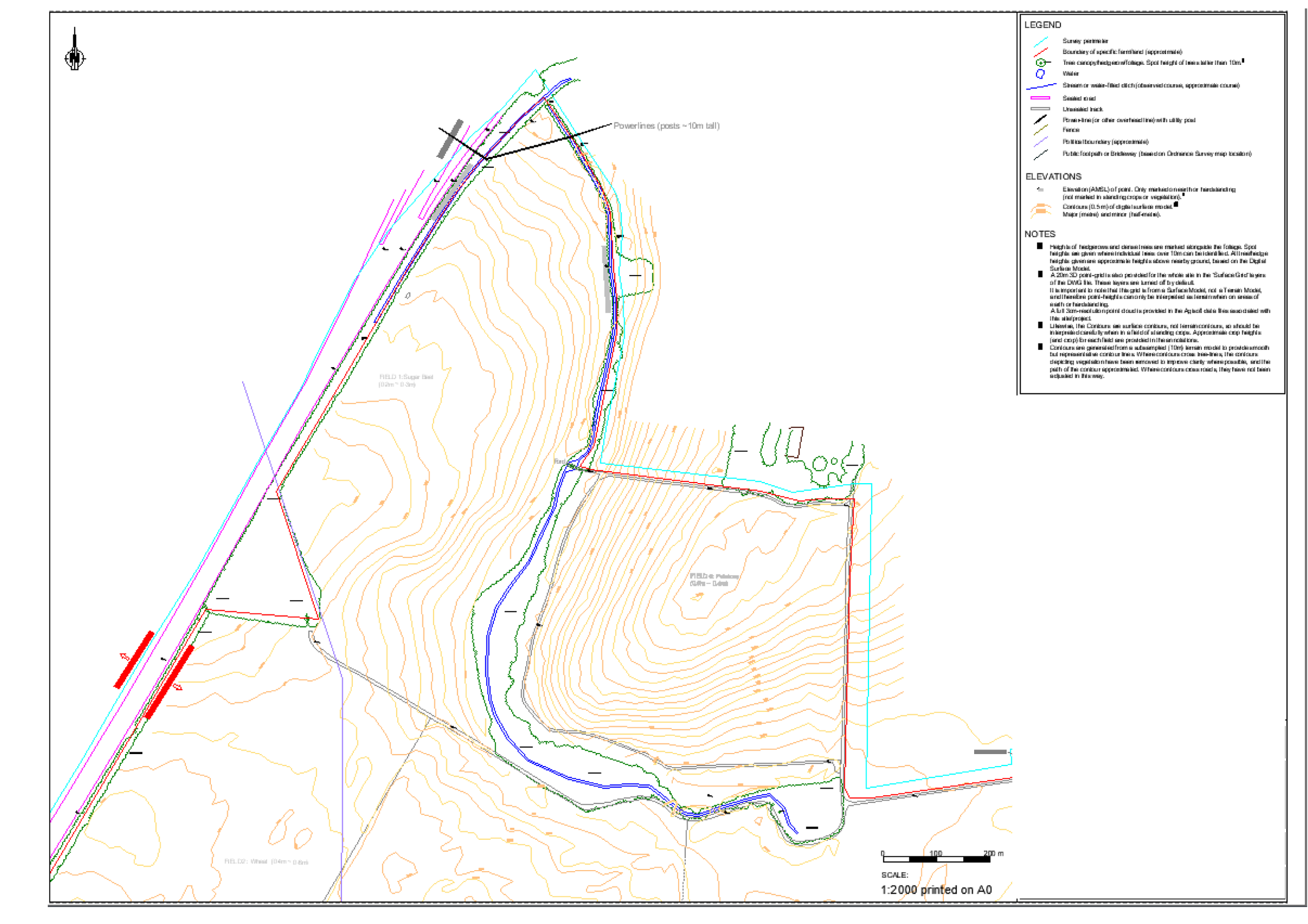
Above Linework
Above provides linework of your site, including contours and labelled layers of important features. We can also perform ground-based surveying of specific features if required.
Examples of important features:
Vegetation
Water (lakes, rivers and ponds)
Roads and tracks
Power lines
Buildings and structures
Other obstacles that may be a potential source of shading or obstruction
Above Linework and orthomosaic details site features such as powerlines, vegetation and other potential obstructions. This example illustrates a combination of drone data and ground-based data.
Be part of the solar plant revolution.
See SolarGain in action, Our team is happy to help!