

Development
Every solar project begins with a vision, but transforming that vision into a buildable, financeable asset requires precision and clarity. Above equips developers with the data and digital tools to understand the land, align teams, and make confident decisions based on the very first survey.

Understanding the Development Phase
From site selection to permitting and financing, the development phase brings together land, engineering, environmental, and grid workstreams.
It’s where opportunity meets complexity, and accurate data, coordination, and visibility can make the difference between advancing a project and stalling it.
Above provides the digital foundation for this stage, giving project teams clear, reliable information and a connected view of progress.

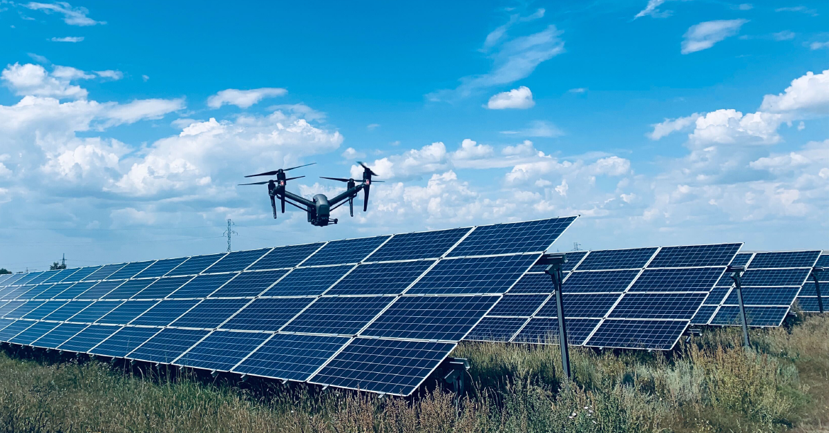
Above delivers precise utility-scale solar topographical surveying and site intelligence for feasibility, design, and yield modelling, using high-resolution aerial data to support faster visualisation and better-informed decisions.
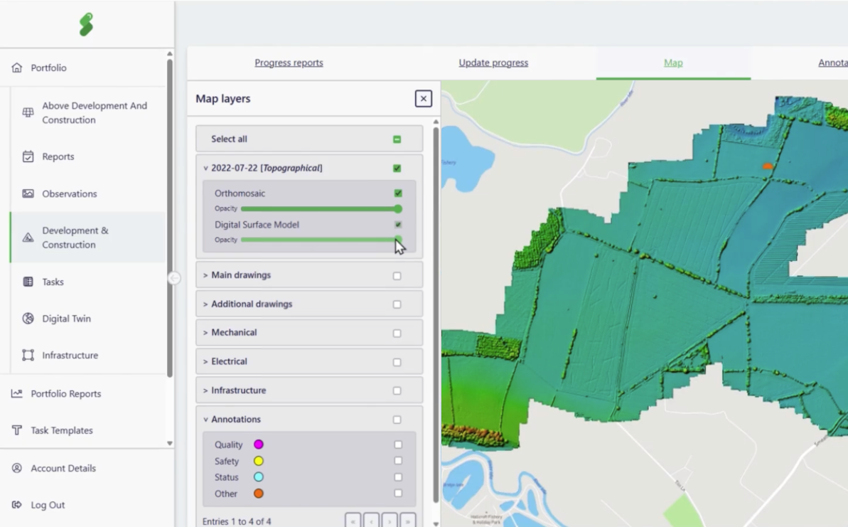
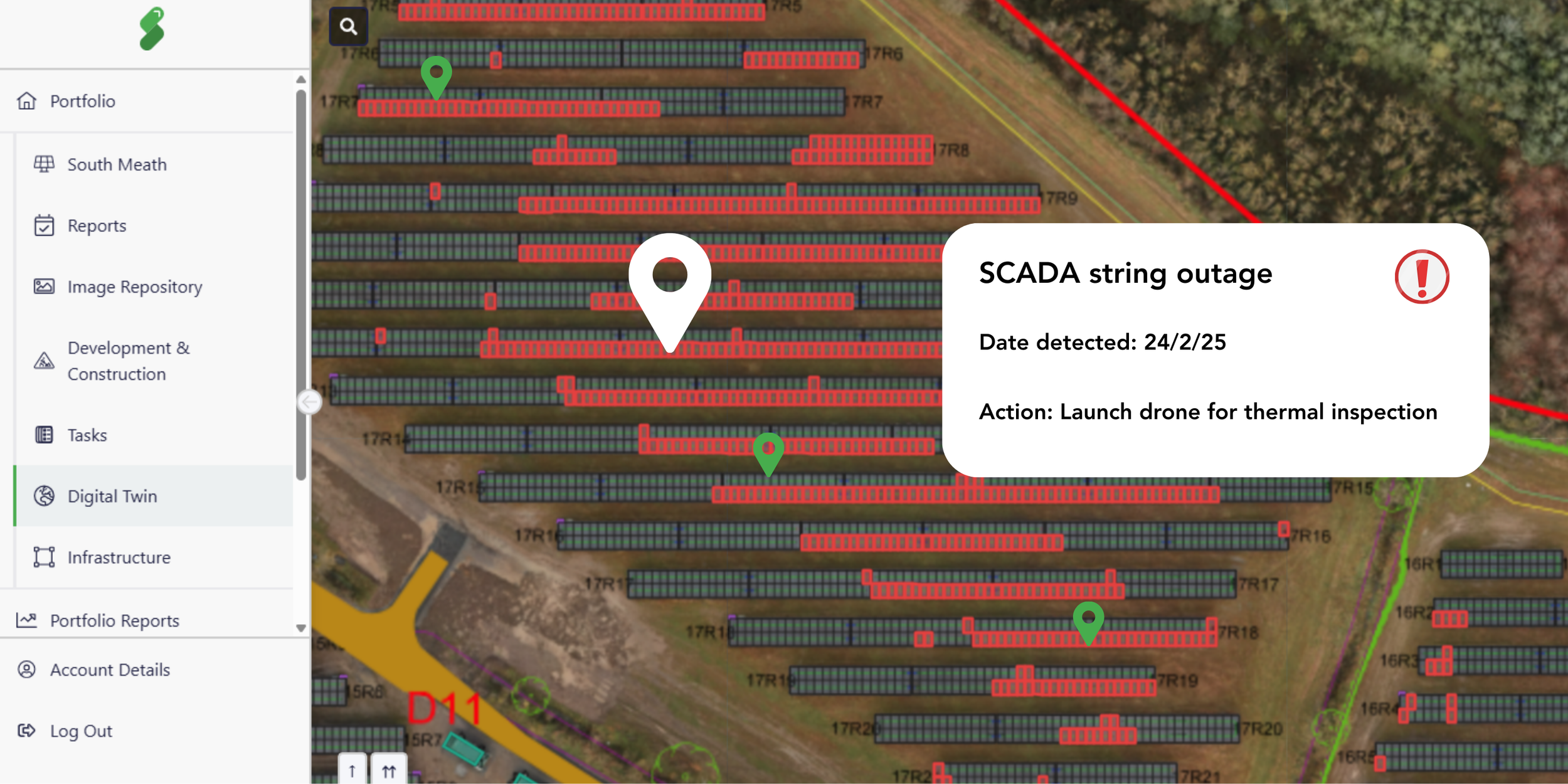
SolarGain SaaS Desktop (Digital Twin)
SolarGain Desktop unifies inspections, physical and electrical layouts, and documentation into one living asset record, giving teams a clear view of the entire plant and supporting better decisions across development, construction and operations.
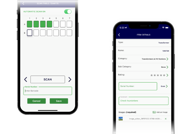
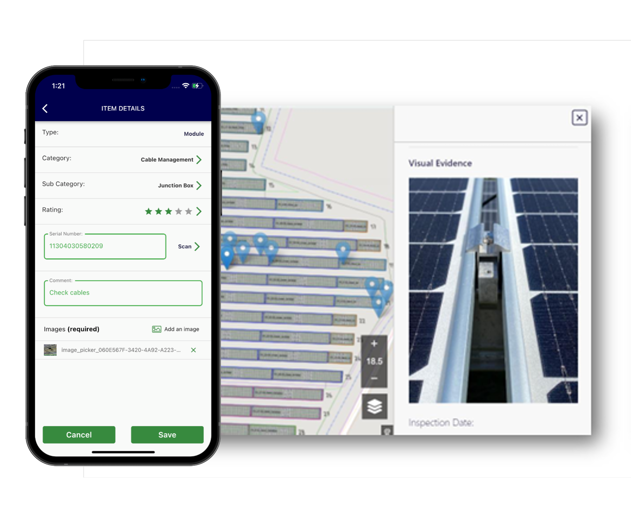
A live digital twin connects field and office teams, capturing on-site imagery and context during inspections while enabling real-time task responses. This greatly improves the efficiency of field activities.
Watch how we can support you
Frustrations that we help you solve

Complex grid and environmental constraints
Integrated aerial data and layered mapping help teams visualise land, grid access, and environmental factors early, reducing late-stage surprises.

Our digital twin connects surveys, layouts, and documentation into one central source of truth.
Fragmented Information

Slow, Manual Updates
SolarGain Mobile synchronises field insights instantly, reducing lag between on-site progress and project decisions.

Design Rework and Cost Overruns
Precise site data and version control help teams catch discrepancies early and avoid costly redesigns.

Aerial topographic mapping data reveals the true landscape, giving design teams accurate terrain models from day one.
Uncertain Site Conditions

Verified data and transparent progress tracking build confidence, making projects more financeable.
Investor Hesitation
Why it matters
The development phase sets the tone for the entire asset lifecycle.
By combining aerial intelligence, structured data, and real-world insight, Above enables projects to reach construction with greater confidence, lower risk, and stronger investor trust.
If you are looking for support for your next project get in touch today
How Above Adds value
Aerial Topographic Mapping delivers precise site intelligence for early feasibility and design.
The digital twin unifies surveys, layouts, and documentation into a single, living record of the project. SolarGain Mobile connects the field and the office, capturing on-site imagery and context directly into the digital twin.
Together, these capabilities create one accurate source of truth throughout development, improving decisions, speeding progress, and strengthening the transition into construction.
FAQs
-
Above’s tools are valuable from the earliest stages of site selection and feasibility. High-resolution aerial data and accurate terrain models help developers understand site potential, while the digital twin keeps all survey and design information connected through to construction and beyond.
-
Verified, traceable data reduces uncertainty, giving investors and lenders confidence in the project’s technical quality. With one consistent record of site information, designs, and progress, Above helps demonstrate diligence and de-risk decision-making during financing.
-
We deliver high-resolution topographic, orthomosaic, and 3D terrain surveys using drones. Each dataset integrates directly into the project’s digital twin, supporting layout design, environmental assessments, and grid connection planning.
-
The digital twin acts as a single source of truth, storing survey data, layouts and documentation in one connected platform. It helps teams track progress, visualise changes, and ensure information continuity as the project moves into construction.
-
Yes. Above’s digital twin and SolarGain Mobile can integrate with existing project management, GIS, or document control tools. Our platform complements established workflows rather than replacing them, improving visibility and coordination across all partners.
-
Most developers benefit from one baseline topographic survey early in planning, followed by targeted updates before construction begins. The frequency depends on site changes, design revisions, or data requirements for permitting and financing.
-
Above doesn’t just deliver data, we create a connected, living record of the project. Our aerial intelligence, digital twin, and mobile tools combine to give teams continuous visibility, clear accountability, and a faster transition from concept to construction.

Bring certainty to development.
See SolarGain in action, Our team is happy to help!