
Topographic Mapping
Marketing leading and purpose-built for renewables, Above’s topographic mapping service delivers high-resolution aerial data for faster project visualisation, more accurate yield modelling and better-informed design decisions, at a fraction of the time and cost of traditional survey methods.
Topographical Mapping
Using a combination of both aerial and ground-based methods, Above delivers a high-resolution Digital Elevation Module of the site including accurate shading scene data.
Service Deliverables
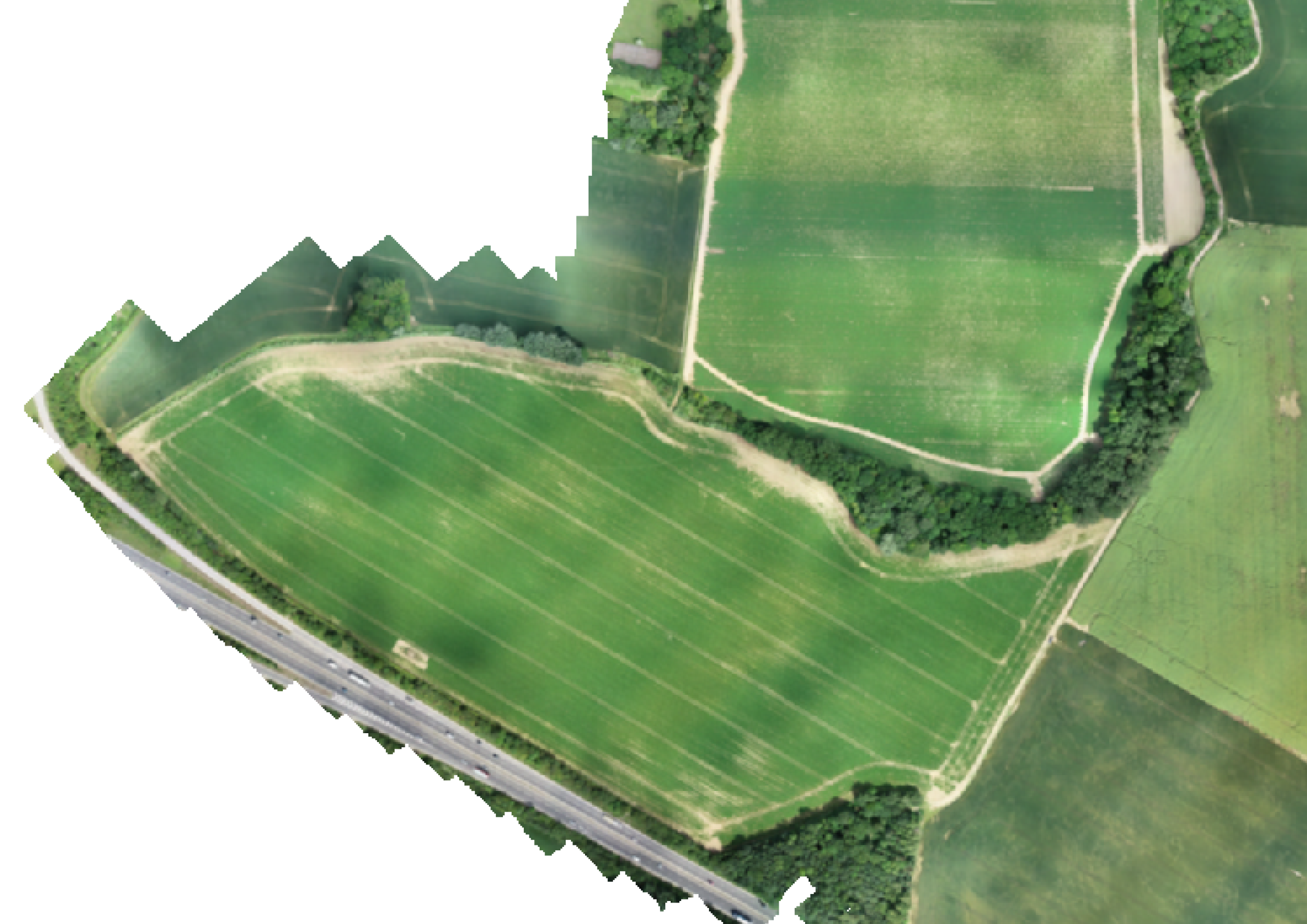
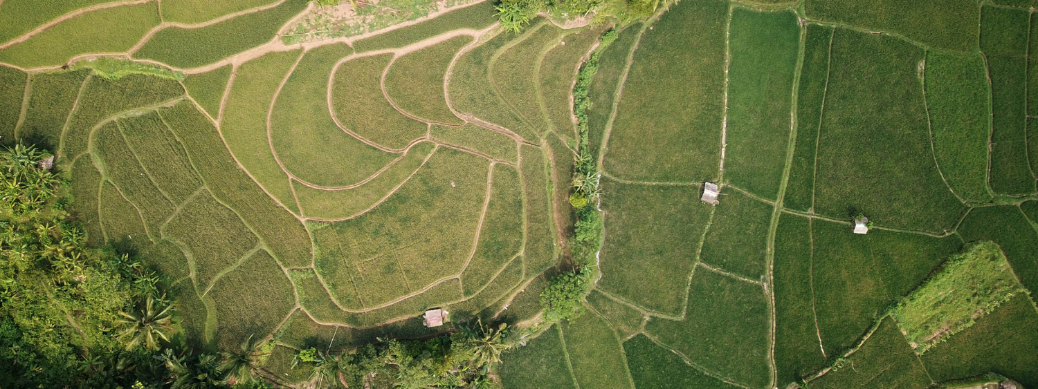
Orthomosaic
A highly accurate and detailed top-down 2D orthometric image of your entire site, created through professional drone surveying and aerial mapping services, providing precise measurements, true-to-scale imagery, and essential data for construction planning, land surveying, and site analysis.
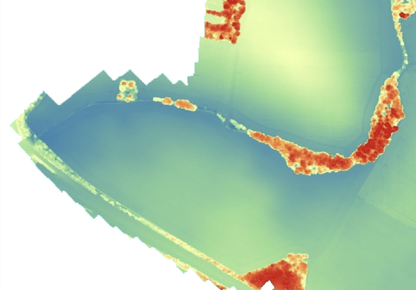
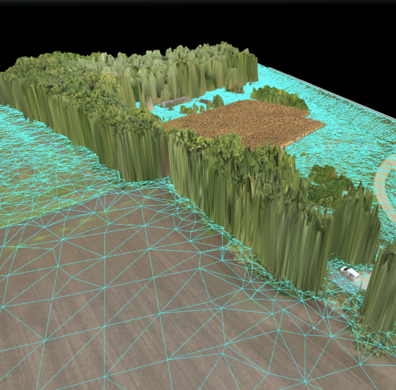
Digital Surface Model (DSM)
A full digital elevation model (DEM) of your site showing the elevation of every pixel, created using professional drone surveying and aerial mapping technology to deliver precise terrain data for confirming terrain profiles, slope analysis - cut-n-fill and site planning.

Linework
Provides site linework with contours and labelled key features. Ground-based surveying can be done if needed.
Key features include:
Vegetation
Water bodies (lakes, rivers, ponds)
Roads and tracks
Power lines
Buildings and structures and other potential obstructions or shading sources
This combines drone and ground-based data to detail site features.
Tin Surfaces
A DTM (Digital Terrain Model) TIN surface will be supplied in LandXML format and linked to the primary DWG deliverable, ensuring compatibility with leading CAD and civil design software.
This dataset supports accurate ground modeling, volume calculations, and site design, making it ideal for professional land surveying and engineering applications.
We provide accurate topographical surveys capturing site levels, structures, boundaries, and key features.
All surveys are carried out using industry-approved equipment and best-practice methods, delivering reliable data suitable for planning, design, and construction purposes, with outputs supplied in formats to meet client and regulatory requirements.


Easily geolocate, store and share site visit information using SolarGain Mobile
Through our site-friendly SolarGain Mobile app, giving teams easy access to accurate survey data on site. Designed for simple field use, it helps crews view key information quickly, work more efficiently, and stay aligned throughout the project.
Advantages of Above’s solution

Industry leading quality
Our services are designed specifically for your project’s needs.

Time and cost effective
Topographic mapping saves you time compared to traditional surveys and at a fraction of the cost

Real-world accuracy
Flight and ground routes are planned by our experienced team, ensuring sufficient row/column overlap. Using GPS-RTK to take ‘ground control’ points across the site to ensure real-world accuracy.

Make informed decisions
Design your plant with confidence using aerial topographic data to inform your design decisions

Team Collaboration
Effortlessly geolocate, store and share site visit data and Tasks in our SolarGain & SolarGain mobile

Plan for the future
Store a visual and spatial record of the land state before plant construction
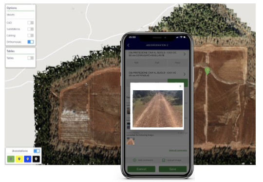
Sneak peak at our software, SolarGain
See how SolarGain simplifies aerial topographical mapping with detailed, high-definition orthomosaic layers. Analyse terrain elevation using the digital surface model (DSM), then measure, annotate and review sites from above all in one place, so you can turn insights into action.
If you’d like to learn more about our software, SolarGain, and how it can support you, request a demo below and a member of our team will be in touch shortly.

Download the Topographic Mapping Brochure today.
FAQs
-
Topographic mapping is the process of capturing detailed spatial and elevation data of a site, including its natural and man-made features. It produces accurate maps and models used for planning, design, and construction.
-
Topographic maps help you understand site terrain, contours, boundaries, structures, vegetation, and services before planning or construction work. They support better decision-making, design accuracy, and regulatory compliance.
-
A topographic survey typically includes:
Site levels and contours
Natural features (e.g., trees, water bodies)
Man-made features (buildings, roads, fences)
Utility and drainage points
Boundaries and elevation data
The level of detail can be tailored to your project needs.
-
Data can be collected using advanced surveying equipment such as GPS systems, total stations, drones, and 3D laser scanners. These tools deliver precise elevation and spatial data for mapping.
-
High-resolution orthomosaic images
Digital surface and terrain models (DSM/DTM)
Linework with labelled features and contours
DWG (CAD), LandXML, PDF, or 3D outputs suitable for design and engineering workflows
Above supplies outputs compatible with leading CAD and civil design software.
-
The timeline varies with site size, terrain complexity, and required deliverables. Typically, surveys are scheduled and completed efficiently using combined aerial and ground-based methods, ensuring rapid data turnaround with high accuracy.
-
Yes, using drone and photogrammetry technology, Above can survey challenging terrain. However, extremely dense vegetation may affect what can be measured from aerial data alone; ground-based methods can supplement where necessary.
-
Topographic mapping is widely used for:
Solar plant design and construction
Land development and planning
Civil engineering and infrastructure projects
Environmental analysis and risk assessment
Architecture and landscape design
-
Accuracy depends on the survey method, equipment, and ground control points used. High-precision survey instruments and RTK GPS control translate into reliable and real-world referenced results suitable for professional planning and engineering.


Be part of the solar plant revolution.
See SolarGain in action, Our team is happy to help!